Huge undersea wall dating from 5000 BC found in France

The structure has lasted 7,000 years
- Published
French marine archaeologists have discovered a massive undersea wall off the coast of Brittany, dating from around 5,000 BC.
They think it could be from a stone age society whose disappearance under rising seas was the origin of a local sunken city myth.
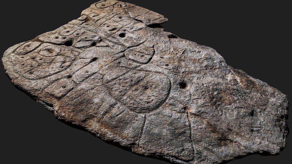
The 120-metre (394ft) wall – the biggest underwater construction ever found in France – was either a fish-trap or a dyke for protection against rising sea-levels, the archaeologists believe.
When it was built on the Ile de Sein at Brittany's western tip, the wall would have been on the shore-line – between the high and low tide marks. Today it is under nine metres of water as the island has shrunk to a fraction of its former size.
The wall is on average 20 metres wide and two metres high. At regular intervals divers found large granite standing stones – or monoliths – protruding above the wall in two parallel lines.
It is believed these were originally placed on the bedrock and then the wall built around them out of slabs and smaller stones. If the fish-trap hypothesis is the right one, then the lines of protruding monoliths would have also supported a "net" made of sticks and branches to catch fish as the tide retreated.
With an overall mass of 3,300 tonnes, the wall must have been the work of a substantial settled community. And to have lasted 7,000 years, it was clearly an extremely solid structure.
"It was built by a very structured society of hunter-gatherers, of a kind that became sedentary when resources permitted. That or it was made by one of the Neolithic populations that arrived here around 5,000 BC," said archaeologist Yvan Pailler.
The monoliths that form the basis of the wall are similar to - but predate - the famous menhirs that dot the Brittany countryside and are associated with the Neolithic culture.
According to Pailler, there could have been a transmission of know-how on extracting, cutting and transporting the stones between older Mesolithic hunter-gatherers and incoming Neolithic agriculturists.
The wall was discovered after local geologist Yves Fouquet studied undersea depth charts drawn up using the latest radar technology. "Just off Sein I saw this 120-metre line blocking off an undersea valley. It couldn't be natural," he told Le Monde newspaper.
Archaeologists made their first exploration in summer 2022, but had to wait till the following winter – when the seaweed had died back – before they could map the wall properly.
In a paper in the International Journal of Nautical Archaeology, the writers conjecture that sites such as this may lie at the origin of local Breton legends of sunken cities. One such lost city – Ys – was believed to lie in the Bay of Douarnenez, just a few kilometres to the east.
"It is likely that the abandonment of a territory developed by a highly structured society has become deeply rooted in people's memories," the paper says.
"The submersion caused by the rapid rise in sea level, followed by the abandonment of fishing structures, protective works, and habitation sites, must have left a lasting impression."
Related topics
- Published9 September

- Published6 April 2021